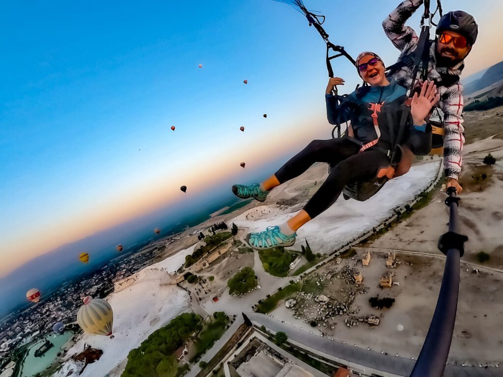
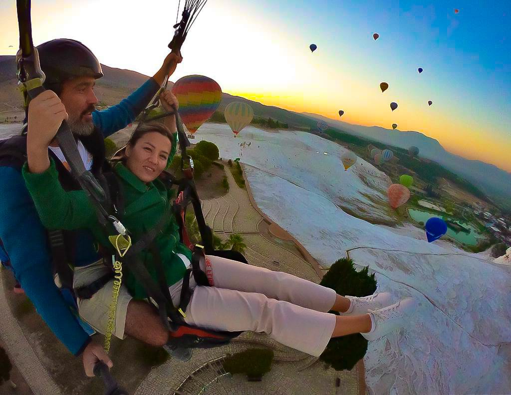
Flying over the Pamukkale Hot Springs and the UNESCO World Heritage Site of Hierapolis
Suitable for…
Beginner, advanced, XC
Best Season
all year round
Altitude difference:
251-1655 m ASL
Accessibility of the starting places by…
Car or Hike & Fly
Particularities:
Pilots must register online before flying. P3 / IPPI Level 3 and proof of insurance required.
Entry fee 50 TL per start / approx. 2,5 € (Feb. 2023)
From the Karahayit take-off site, without thermals, it can be difficult to get over the row of trees on the way to the to the main landing area next to Pamukkale. If in doubt, turn right beforehand and use the endless outer landing areas below the travertines.
User-review for this spot:
Do you know this spot? Send us your review!
Flying in the middle of a world heritage site
Paragliding over the hot springs of Pamukkale and the archaeological site of the UNESCO World Heritage Site of Hierapolis is arguably one of the most unique and impressive moments of paragliding in Turkey.
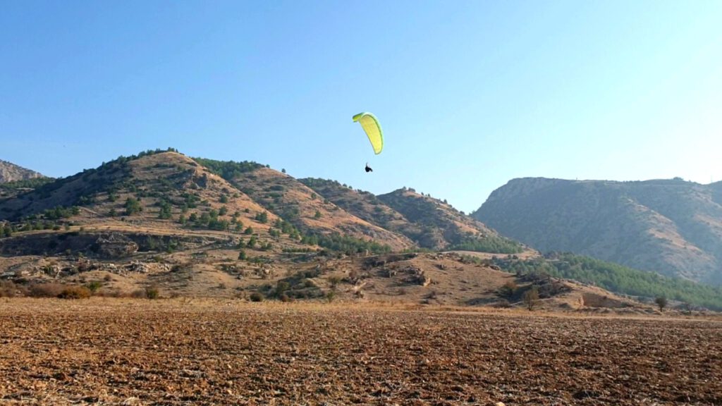
2 launch sites directly above Pamukkale and one approx. 20 km to the north-east provide good opportunities from gliding down to small and medium XC excursions. A wind range from SE-W is covered.
The highlight, however, is definitely the partly surreal impression that opens up when flying over the limestone terraces. On a cross-country flight from Cökeleç to Pamukkale, you can wonderfully shimmy along the various thermal springs. These give a constant lift by expelling warm and humid air.
Pamukkale is much more than just a paragliding area. In addition to flying, the area invites you to study in detail the 19 surrounding ancient cities, as well as the more than a dozen different thermal springs, all of which are unique with their different colours. Interesting destination if your plans are not just about flying onnly. Perhaps not the best choice with children.
If you’ve ever thought about taking a ride in a hot air balloon – there are few more exciting places to fulfil that dream.
Online registration required for pilots / 50 TL entry fee per start
Pilots must register online before their flight. The level of the pilot’s licence or its international translation for tourists (IPPI Fly-Card) as well as liability insurance are requested. Of course, the originals of these documents must be available on request. To fly in Pamukkale, proof of pilot level 3 / IPPI 3 is required. A launch fee of 50 TL per launch is payable at the launch site.
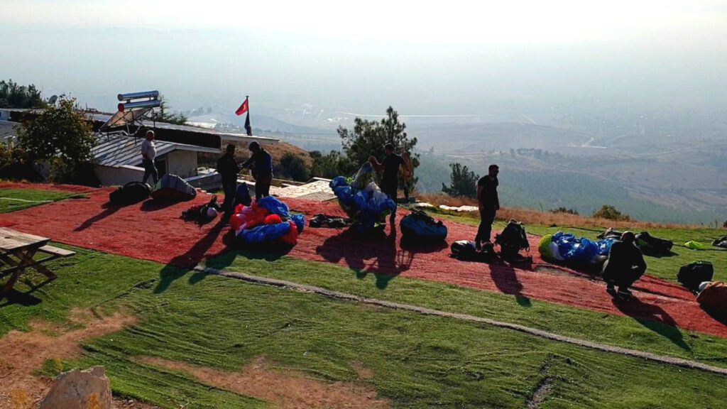
Take off sites at Pamukkale, summery
The 3 launch sites in Pamukkale offer everything from beginner glides, to pleasure flights, to smaller and larger XC-Adventures.
Klicken Sie auf den unteren Button, um den Inhalt von embed.windy.com zu laden.
Karahayit Take off , SW-W, 881 m ASL
| Diection | SW-W |
| Type | Slope |
| Coordinates | N 37°57’32.08″ E 29°08’01.03″ |
| Altitude ASL: | 881 m |
| Altutude difference | 630 m / 512 m – depending wich landing area |
| Transfer | Car, Hike and Fly |
| Landing area | Main landing area next to Pamukkale: N 37°55’18.21″ E 29°06’55.46″ (251 m ASL) Northern landing area: N 37°56’33.29″ E 29°07’10.91″ (369 m ASL) |
| Remarks | Spacious artificial grass launch site. Restaurant and WC and at the launch site. |
Dinamit Takeoff, W, 702 m ASL
| Diection | W |
| Type | Slope |
| Coordinates | N 37°56’35.42″ E 29°08’09.76″ |
| Altitude ASL | 702 m |
| Altitude difference | 451 m / 333 m |
| Transfer | Car, Hike and Fly |
| Laning area | Main landing area next to Pamukkale: N 37°55’18.21″ E 29°06’55.46″ (251 m ASL) Northern landing area: N 37°56’33.29″ E 29°07’10.91″ (369 m ASL) |
| Remarks | Spacious artificial grass launch site. Restaurant and WC and at the launch site. |
Gökelec Takeoff (20km NE of Pamukkale), SO-O, 1655 m ASL
| Direction | E-SE |
| Type | Slope |
| Koordinaten | N 36°31’42.57″ E 29°09’02.74″ |
| Altidude ASL | 1655 m |
| Altitude difference | 408 m 1404 m XC nach Pamukkale |
| Transfer | Car, Hike and Fly |
| Landding area | Main landing area Güzelpinar: N 37°57’32.28″ E 29°14’34.56″ (1247 m ASL) At Pamukkale: N 37°55’18.21″ E 29°06’55.46″ (251 m ASL) |
| Remarks |
Fantastic impressions and a great flying area for gliding, pleasure flights and XC-Adventures
After taking-off and a short flight towards the SW, the archaeological site of Hierapolis and the white limestone terraces open up below. It is an almost surreal impression that opens up here. There is one last band of updrafts above the limestone hilltop before you reach the landing site in front of Pamukkale. It gives you the opportunity to observe in detail the tourist hustle and bustle in the terraces below you. Moments that you will never forget and confirm that flying is the best way to discover a foreign country.
From the Karahayit take-off site, the landing site in front of Pamukkale can only just be reached. Without thermals, it can be tight, especially over a row of trees that are precariously close to the glide path on the way. If in doubt, swerve to the right and make use of the infinite outside landing areas. For beginners, a glide from Karahayit directly to the northern landing site is certainly the safer choice. Even though the northern landing site is an unleveled natural area, slopes gently and recommends good, ankle-high footwear.
The Cökeleç launch site is the starting point for one of the most widely flown standard XC routes in Turkey. From here, one can tackle predictable cross-country flights along the approx. 55 km long terrain chain in NE direction. Another route is towards Pamukkale. Somewhat less obvious, but along the thermal springs that consistently release warm and humid upwellings and quite feasible due to the 1200 m elevation gain. Due to the geothermal conditions, the route towards Pamukkale in particular also works in winter. And offers an easy, not overtaxing environment for the first XC flights, for pilots who want to venture on the track once.
Pilot level
Independent pilots, minimum requirement IPPI P3
Pamukkale is an easy flying area. The two take-off sites, Dinamit and Karahyit, are excellently prepared, spacious and with a medium gradient. The main landing field on the outskirts of Pamukkale is also large and well equipped with artificial turf.
When gliding without thermals, the way to the main landing field can be quite long. Consider an outlanding beforehand, as there are plenty of options. A safe option is always to fly directly to the northern alternate landing site.
Guiding (extended briefing before the first flight) or day care can be booked on request.
Cökeleç is also suitable for beginners in calm conditions to enjoy a glide to the landing site 400m below.
Experienced pilots
In Cökeleç, dreams come true for cross-country pilots. It is one of Turkey’s XC flying areas and makes cross-country pilots’ hearts beat faster. The main route goes NE along an approx. 55 km long chain of hills and in the high valley in front of it. But flights to Pamukkale are also frequent and well possible even in winter.
Tandem flights / Passenger flights
Several tandem pilots offer passenger flights for locals and guests through local schools or directly. Professionally conducted tandem flights are offered in different languages and can be booked with us.
Foreign tandem pilots must register / apply for their non-commercial flights 5 days in advance. Commercial flights are not permitted for foreign tandem pilots.
Lessons
Paragliding lessons are offered by various local flight schools. This is certified by the Turkish Paragliding Association and offers you the training as part of the issuance of a Turkish flight license.
Do you know this spot?
Share your experiences with us!
Amazing experience with Ayse and Alex
From the moment we took off, soaring through the sky, the thrill was unparalleled. Their expertise and guidance made the adventure not only safe but also incredibly enjoyable. The breathtaking views and the rush of adrenaline made it an unforgettable experience. Overall, an amazing adventure with skilled instructors that left me wanting to soar again!
Mehr infos über die Region findest du auf unserer Seite:::